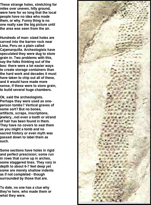
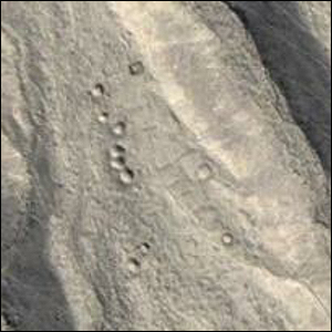
 by Gary Vey for Viewzone Of all the ancient cultures in South America, perhaps the most mysterious are those found in and around the rugged mountains of Peru. The area is such a harsh environment, with steep inclines, temperature extremes and a scarcity of water to sustain crops or man, that it is a puzzle why ancient cultures settled here. But settle they did, often building large living centers from stone at very high altitudes where low atmospheric pressure makes even walking a breathless task. 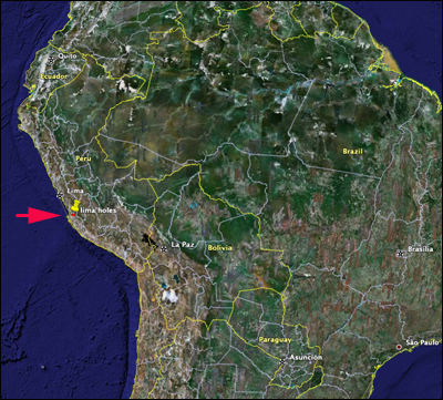 While the world is generally familiar with Machu Picchu and the Nazca Lines, another mystery has come to light through the modern science of satellite photography. This phenomenon is one that was previously known but the extent of its size and effort required to make it is just being fully realized. A series of holes, usually about 24 inches across and in neat rows of from nine to twelve, stretch for almost a mile in Peru. It starts at the base of a mountain and then climbs up the side and meanders up and down, over some of the roughest terrain. 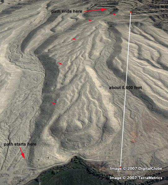
In his book, Zecharia Sitchin describes how the annunaki set up a colony in Peru to look for gold, following their disappointment with sea mining. It has been suggested that these holes appear similar to excavations conducted by mining operations, perhaps searching for a vein of precious metal. Similar holes have been encountered from attempts to locate water, although the liklihood of finding water in these stone mountains seems very remote. What made the ancient people of this era toil in such inhospitable conditions to create these holes? How long did it take them? What sustained them while they labored so hard? These mysteries remain to be answered.
Evidence of the same holes on Mars! Comments: Just thought you would like to know about another strange spot nearby @ 13.43 4.0 - 75.53 21.0 I call it 'Holes & Furrows' This is different from the first mentioned holes in many ways but, if the holes are consistent with the other site depth, spacing, tool marks etc) then I would propose a theory. Continue reading post with images... Hi. I know they are not the same but I have noticed some 60 foot holes in California near I-5 and the Oregon border. No one knows who made them and they too are in a sort of neat row formation. I have enclosed a photo. They are at 41 53'22.88"N 122 05'26.78"W. 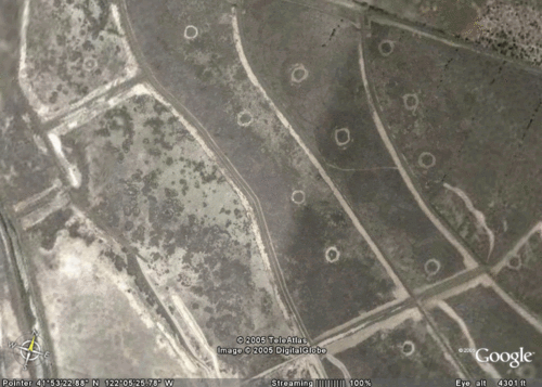 Maybe someone knows? Barry Hi. Cobra My theory is that when ever a local young man wanted to prove that he was ready to join the adult society he had to dig one of these holes using implements that he had fashioned himself, perhaps even within a given time frame.. Since it was such a rugged environment, manual skills and endurance were the necessary elements of success as an adult. These holes were the testing grounds. The size, shape, relationship to the other holes were all important considerations. The best hole diggers might even have landed the most desirable maidens. The weaker contestants who could not dig a suitable hole were not allowed to have any maidens at all. This automatically weeded out the weakling born into the group. The custom fell out of favor when the people realized that the best diggers were not always the smartest. JMills Perhaps they're a defensive measure? Something to hinder an enemy. Tom Damon from first glance, i'd say it was a security feature. like a wall. it has the same impact as a wall, it stops a large force from crossing. individuals might not have a problem stepping around the holes, but an army of people would. I'd imagine it would scare people from entering the area if they thought they would fall in. fasterdogs I just wanna comment on the last photo attached by Barry about the 60 foot holes in California. They are underground missile silos. And of course aiming the Russian Federation. In case of trouble... cobrabubbles perhaps the holes were support for timber or some bio dergadable that served as upright barrier Dr. Paul Recher I would seggest that perhaps there was a settlement near the bottom of this hill and that these holes were designed to hold water and prevent a landslide... or perhaps to hold water for use in irrigation or for drinking. Bill P. Hey, Tom S. Could this be some ancient archaeological excavation that was done, perhaps looking for some buried artifacts? Mike A.
|
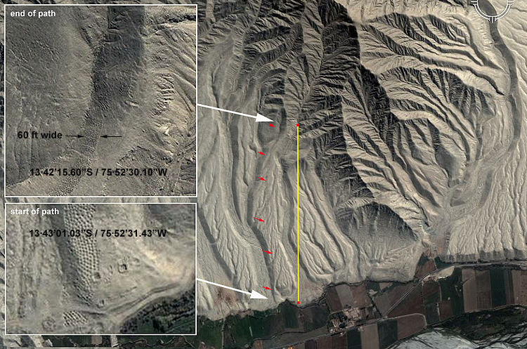
 The remains of an ancient settlement can be seen near the Southern part of the path, distinguished by two large craters, measuring about 24 feet across. Elsewhere in the mountains, other ancient structures and foundations can be seen from satellite imagry [right], but have not yet been excvated.
.
.
.
.
.
.
.
If you have a history or archaeological related article to submit, send it to:
Editor/viewzone.com
myristicin@hotmail.com