

Editor's Note: While this story has gone viral and has been picked up by the main stream media, we want to thank the brave Chinese woman who sent this to viewzone and also to Haisheng Liu, who translated the text for us. With all the speculation we remind readers that the images and coordinates provided to viewzone were accompanied by an explanation. That's probably the smartest place to start.
Share:   |
Haisheng Liu for viewzone.com
I was asked to translate a recent submission to viewzone that contained the following images, taken from the google-earth program. Of course I checked the archives to be sure they are correct and noted the GPS coordinates so anyone can confirm that these things are real.
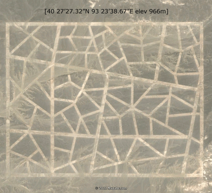
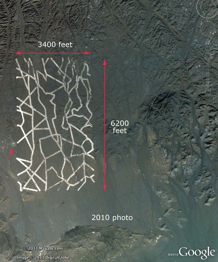
The top of this unusual rectangle construction spans 5670 feet -- over a mile -- and the road-like structures are as much as 100 feet wide! Google-earth images show the construction at various times going back to 2005. It is always covered with mud and the surrounding land shows no signs of activity for miles (except some miles to the West, where a perfect square of earth about a mile wide has been covered over with sand). Prior to 2005 the google-earth images are blurred in this specific area, suggesting it is not new. It appears to be made somewhat thick as it has not buckled or cracked over the years.
Google now has a feature where you can view the exact location at different times in the past. Some photos go back 10 years. In this way you can see what has happened over time. The "puzzle" construction is very old and appears in the earliest satellite images (when not obscured on purpose). But wait, there's more weird things in this immediate area:
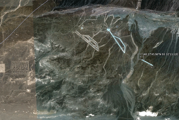
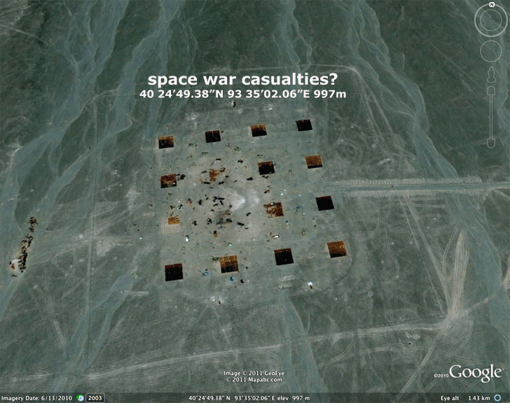
As you will want to see these for yourself, the coordinates are provided. Zoom in on some of the remains of buildings and camps. They are all vacated and look like they were ransacked. There's a sign of an explosion in places with the ground riddled with 10 foot craters, as if cluster-bombed. And the two large, reflective shapes... are they runways? antennae? symbols?
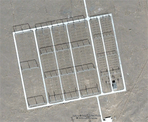
With a little exploring I came across this image of a remote village -- I mean in the middle of nowhere -- devoted to laying out this reflective stuff in a specific pattern. So much care has been spent to get these shapes exact. If you look closely you can see some straight lines, a "V" shape, as if pointing the way to something...
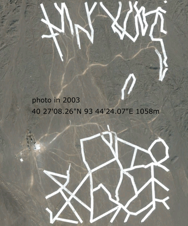
And here, at the end of the runway, antenna, symbol (whatever) is this odd thing.
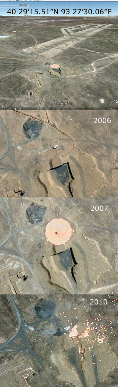
 Orange blocks, as big as cargo containers, are stacked in a circular manner around a small house. Then, sometime after 2007, there is a powerful explosion and the containers are scattered as much as a three miles from their original site. But some containers remain in formation and it looks as if the circular form actually moved relative to the central "house"... What happened? What is this place?
It even has a HAARP-like installation (see 40 24'17.50"N 93 38'15.75"E) with antennae lengths indicating a 200 meter frequency.
What we were told in the email:
The reader says this is Top Secret area in a remote part of China. This is the Chinese "Area 51" where "captured" (alien?) technology is kept and tested. It is also near by where the nuclear bombs were detonated many years ago. Supposedly the main laboratories are underground. You can see the entrances if you look at the images. "Contact" has been made with other "technology" (?). A new propulsion system was being tested. But it was not well controlled and could not be stabilized. An accident happened and the device blew up. The area is "very contaminated" now, probably why we see no human activity (i.e. vehicles, habitation etc.).
Then there's this:
There certainly is strong evdence that something came from "above" and blasted this site (and most others in the area). Is this all just a hoax? Check this for yourself with google-earth and let us know what you find.
COMMENTS:
Hey look at 44 42'40.81"N 93 31'46.18"E -- this is some kind of antennae or something. It's HUGE! Wow, this stuff makes our Area-51 look limp! LOL
TJ357
Reply to TJ357. Some of what you see are the power lines for existing or future wind generators. China has a massive solar and wind energy program and the turbines are arranged in precise grids -- sometimes for tens of miles.
Here is an example of the same phenomenon in Colorado. It's a mile wide triangle which looks like it might have been a runway -- except there are no main roads around it. Maybe in the past? Check it out.
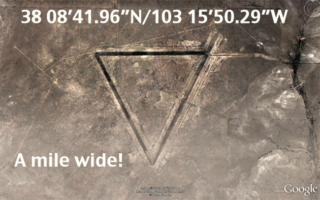
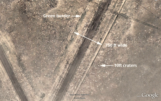
Notice the green trim defining the shape -- also there are thousands of 10ft pits just like in China! And these show up as far back as 2001. Anyone know what this is all about? Was there like an interplanetary war and we lost? Or maybe these are used for military target practice? lol
E.Paboda
Check out the mate to your triangle in colorado. it's not far from the first one, pointing in the opposite direction. this is NOT a runway. 38 20'14.67"N 103 16'38.50"W. I'm looking for the other two directions now... lol.
bozinoz
Don't bother with these old runways. They were used for practice as part of the Advanced Flying School at La Junta AAF and later as auxiliary bases, but abandoned post WWII. I suspect the same is true of the Chinese "runways" as they seem the right shape and size for large bombers. The underground facilities would be where the bombs were stored. IMO anyway.
BriBand